Explore · Mae Kampong
Ban Mae Lai Village
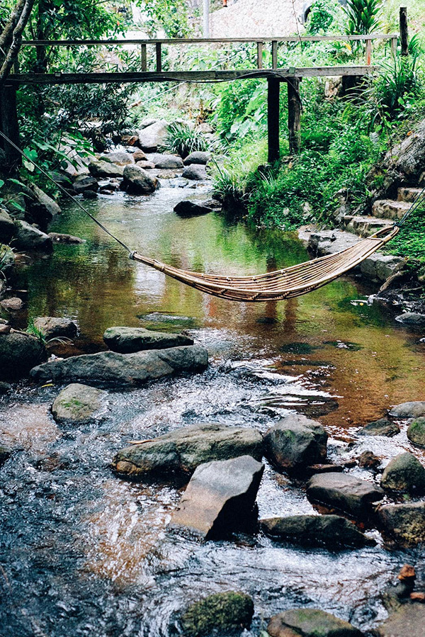
A forest stream community near Mae Kampong
About and management · Ban Mae Lai Village
Ban Mae Lai is a residential community in Huai Kaeo, Mae On, rather than one centrally managed attraction. Individual hosts and businesses operate accommodation and cafés; local authorities are relevant to public roads and shared infrastructure. Thailand’s tourism authority describes its streamside landscape and road connection to Mae Kampong.
Ban Mae Lai is a lived-in community. Stays, cafés and private premises are operated individually; roads and public spaces involve relevant local authorities. Visitors should respect residents rather than treating the whole village as a resort.
Explore
Ban Mae Lai is another village in Huai Kaeo, about 4 km from Mae Kampong according to the Tourism Authority of Thailand. Its streamside stays, cafés and village temple offer a useful comparison with the better-known neighbour.
Enjoy a short riverside stop and a local café without entering private homestay areas uninvited.
Visit planning
Daytime in suitable weather
What to notice
A smaller streamside settlement about 4 km from Mae Kampong.
- Stream and small bridges
- Bamboo and timber riverside stays
- Wat Mae Lai and locally sourced stone details
Essential information
- Location
- Ban Mae Lai, Huai Kaeo, Mae On District, Chiang Mai 50130, Thailand
- Explore
- Riverside community village
- Opening hours
- Public village lanes and private cafés or homestays operate under different access conditions.
- Admission
- There is no single village-wide sightseeing ticket; food, stays and services are charged independently.
- Best time
- Daytime in suitable weather
Opening hours
Public village lanes and private cafés or homestays operate under different access conditions.
Admission
There is no single village-wide sightseeing ticket; food, stays and services are charged independently.
Getting there
Mae Lai is about 4 km from Mae Kampong, linked by a local road according to Thailand’s tourism authority.
Open Google Maps ↗Background
Its forest valley and stream helped establish nature-oriented stays and cafés alongside the existing community, with several different styles of accommodation.
What to notice
Look for timber bridges, bamboo cabins, shallow streams and stone details associated with Wat Mae Lai.
Core experience
Enjoy a short riverside stop and a local café without entering private homestay areas uninvited.
Suggested route
- Travel from Mae Kampong using a vehicle suitable for local roads
- Explore only publicly accessible stream and bridge areas
- Stop at a café or local restaurant
- Return to Mae Kampong or stay overnight with a confirmed booking
Before you go
Some bridges, decks and riverfront areas belong to private stays. Ask before entering, and stay out of streams during high water.
Photography spots
Frame timber bridges and running water from public paths.
Where to stay
For an unhurried morning or evening visit, consider a village homestay and book ahead. Where to stay
Visitor reviews
Read current feedback on the individual Google Maps listing. The village rating does not represent this separate place.
Google Maps ↗Frequently asked questions
- How far is it from Mae Kampong?
- The Tourism Authority of Thailand describes it as roughly 4 km away.
- Can I enter homestay decks to take photos?
- Ask each property owner before entering.
Address and navigation
Ban Mae Lai, Huai Kaeo, Mae On District, Chiang Mai 50130, ThailandOpen Google Maps ↗Reference: https://thai.tourismthailand.org/Attraction/หมู่บ้านแม่ลาย